
Product Technology · Handheld SLAM · Point Clouds
Cobra Handheld SLAM Scanner: Built for Complex Sites
Real-time field feedback, RTK-SLAM fusion, and MX-Fusion processing connect complex-site capture with colorized point clouds and 3D deliverables.
Forested terrain, underground corridors, aging industrial sites, and active construction areas rarely offer ideal conditions for 3D scanning. Sightlines are interrupted. Lighting changes between spaces. Satellite reception can disappear beneath structures or below ground. The challenge is to capture connected, useful spatial data while working through those conditions.
Cobra brings LiDAR, multi-view cameras, an inertial measurement unit (IMU), and RTK positioning into a handheld SLAM scanner. Its field workflow combines on-device point-cloud preview with MX-Fusion processing, taking the operator from capture to colorized 3D data for surveying, documentation, modeling, and digital-twin applications.
01 / A tool for the field
Start scanning. See what you have captured.
A portable scanner is most useful when the operator can move through the site, see the capture progress, and address gaps while still in the field. Cobra’s integrated design brings the scanner, display, and controls together, with the LiDAR facing forward and the screen within view.
Quick startup and gravity calibration
Cobra integrates gravity calibration into the startup workflow, reducing the need for a separate stationary initialization routine. Once the system is ready, begin collecting data and building the map while moving through the site. SLAM capture does not require a target-based setup.
5-inch live point-cloud preview
The integrated 5-inch AMOLED touchscreen displays the developing point cloud. Review coverage, look for missing surfaces or disconnected areas, and revisit them before leaving the site. The preview gives the operator immediate feedback rather than deferring every coverage check to the office.
Low-light imaging adds visual context
Cobra’s wide-view, low-light cameras capture imagery for point-cloud colorization in dim interiors and spaces with changing illumination. The camera system provides 25.2 megapixels in total across its views. Combined with LiDAR geometry, that imagery helps make features such as openings, painted surfaces, and equipment recognizable in the processed result.
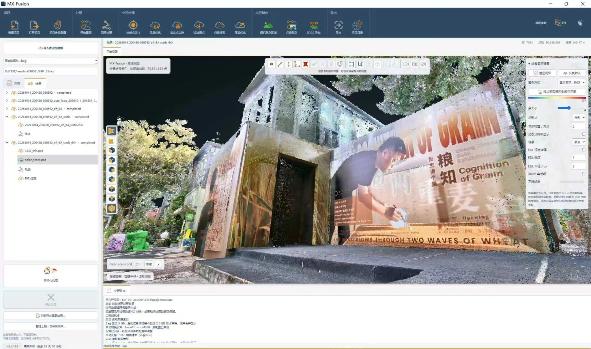
At a building entrance, context extends beyond the doorway itself. Steps, wall surfaces, adjacent structures, and vegetation all help explain how that entrance fits into the site. Capturing those relationships creates a more useful record for existing-condition review and planning.
02 / Connected spatial capture
Move between outdoor and GNSS-denied spaces.
LiDAR measures surrounding surfaces. SLAM—simultaneous localization and mapping—uses the observations to estimate the scanner’s movement while building a map. Cobra combines that process with IMU and camera data, with standard RTK positioning available for outdoor coordinate referencing.
RTK outdoors, SLAM where satellite reception drops
Outdoors, RTK uses satellite observations and correction data to support absolute positioning. Beneath roofs, inside buildings, or along underground corridors where GNSS reception is unavailable, SLAM continues mapping from the surrounding environment. This combination supports capture routes that cross different positioning conditions.
For a georeferenced project, RTK correction access and the project coordinate reference remain part of the field plan. SLAM can map without GNSS; a locally coherent map and verified absolute coordinates are distinct requirements.
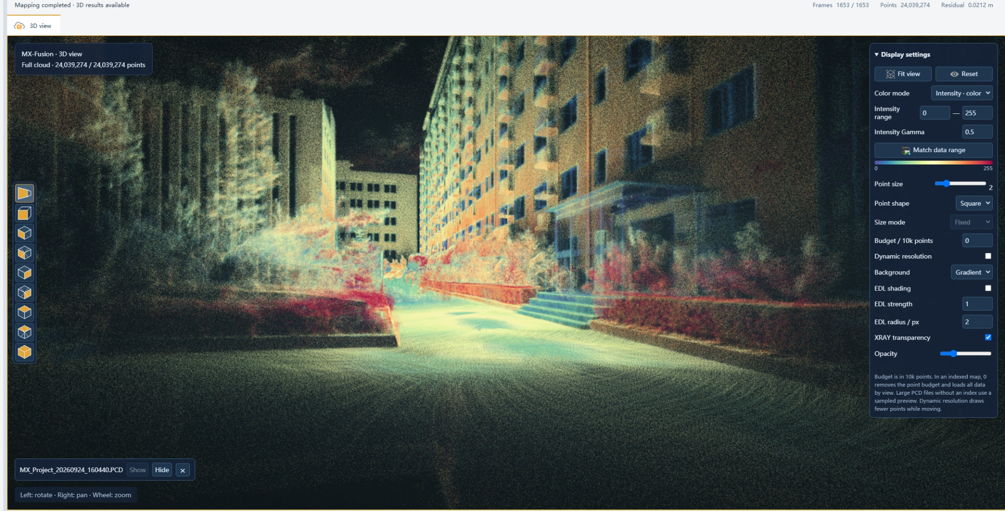
The urban corridor view shows why connected capture matters: opposing façades, the route between them, and intervening vegetation need to sit within the same spatial frame. Review both the overall connection and local coverage, especially where repetitive geometry or obstructions limit the available observations.
Explore how LiDAR and SLAM work together →03 / Adapt the capture
Choose the sensor and scan mode for the site.
Cobra uses a unified platform with different LiDAR configurations. Cobra S pairs the platform with Livox Mid360, while Cobra X offers Hesai XT16 or XT32 modules. These options let teams balance field of view, point rate, range, and carrying weight around the environment they need to document.
Cobra S / Livox Mid360
Broad vertical coverage
A 360° × 59° field of view and 200,000 points per second support portable capture across indoor and outdoor spaces. The listed scanner weight is 1.28 kg.
Cobra X / Hesai XT16 or XT32
Sensor choice for capture density
XT16 and XT32 configurations provide 320,000 and 640,000 points per second, respectively, with 360° horizontal coverage. The listed scanner weight is 1.92 kg.
Static and rotational scanning
Alongside mobile capture, Cobra supports static and rotational scanning, including specified-angle operation. The operator can select a mode suited to the target and available working space rather than relying on a single capture pattern for every scene.
Sensor range depends on the selected module and target conditions. For the full configuration comparison, see the Cobra specifications.
04 / Process and refine
Turn the field scan into usable 3D data with MX-Fusion.
The field scan brings together LiDAR returns, motion observations, positioning data, and imagery. MX-Fusion processes these inputs into a connected reconstruction, with tools for viewing, refinement, measurement, and export.
Global optimization and point-cloud refinement
MX-Fusion combines SLAM optimization with global alignment and bundle adjustment (BA). It refines camera poses and point coordinates using LiDAR and visual constraints to improve consistency across the reconstruction. Its processing tools also include noise and outlier removal, fine registration, and point-cloud refinement.
The software’s CNN-based processing includes depth estimation, feature enhancement, and denoising. Together, these operations address problems such as drift, misalignment, doubled surfaces, and distortion. Processing quality still depends on the observations captured in the field; missing coverage needs additional capture rather than a promise of automatic recovery.
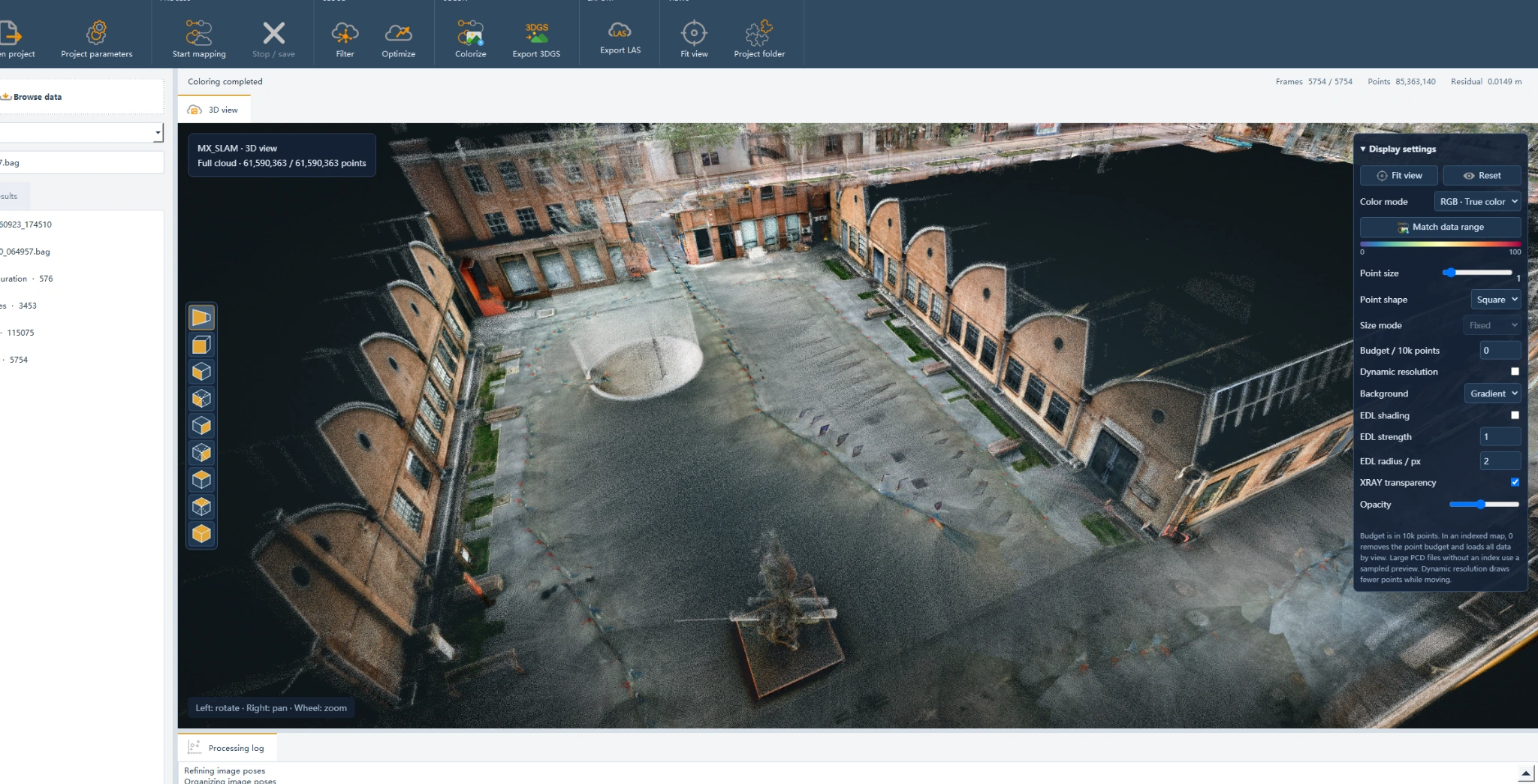
At courtyard scale, the value of a connected reconstruction is easy to see. The open ground and surrounding façades form a spatial overview that can support site review, layout discussions, and planning. Smaller areas can then be examined within that wider context.
Color fusion for recognizable surfaces
MX-Fusion projects image color onto 3D points and balances color across camera views. Low-light image fusion and multi-frame texture fusion help connect the measured geometry with the visual information people use to identify a place.
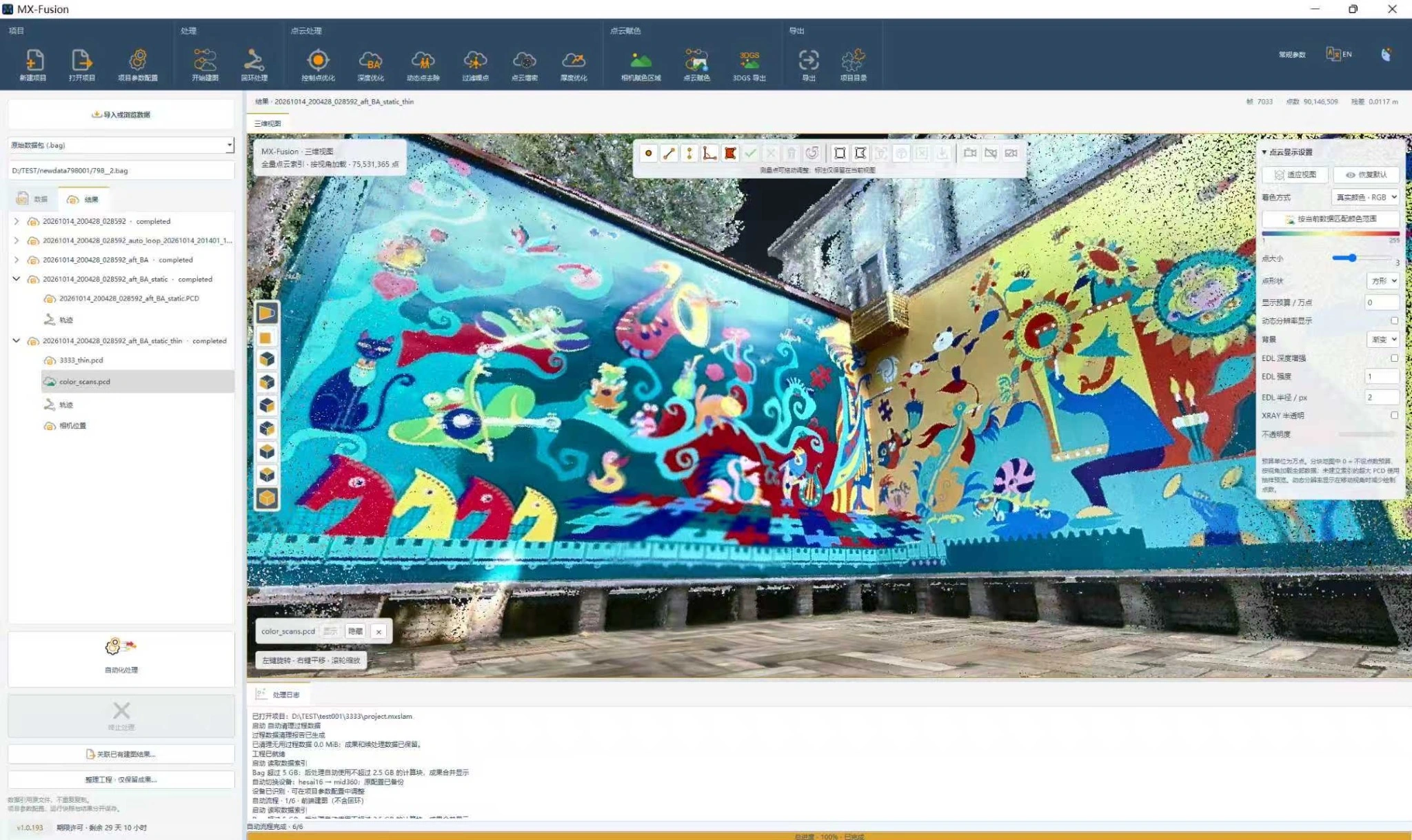
The mural scan illustrates that relationship. Color communicates the painted design, while the point-cloud geometry preserves the arrangement of the walls and surrounding surfaces. The result is useful for discussing heritage documentation, digital archiving, and visual scene reconstruction.
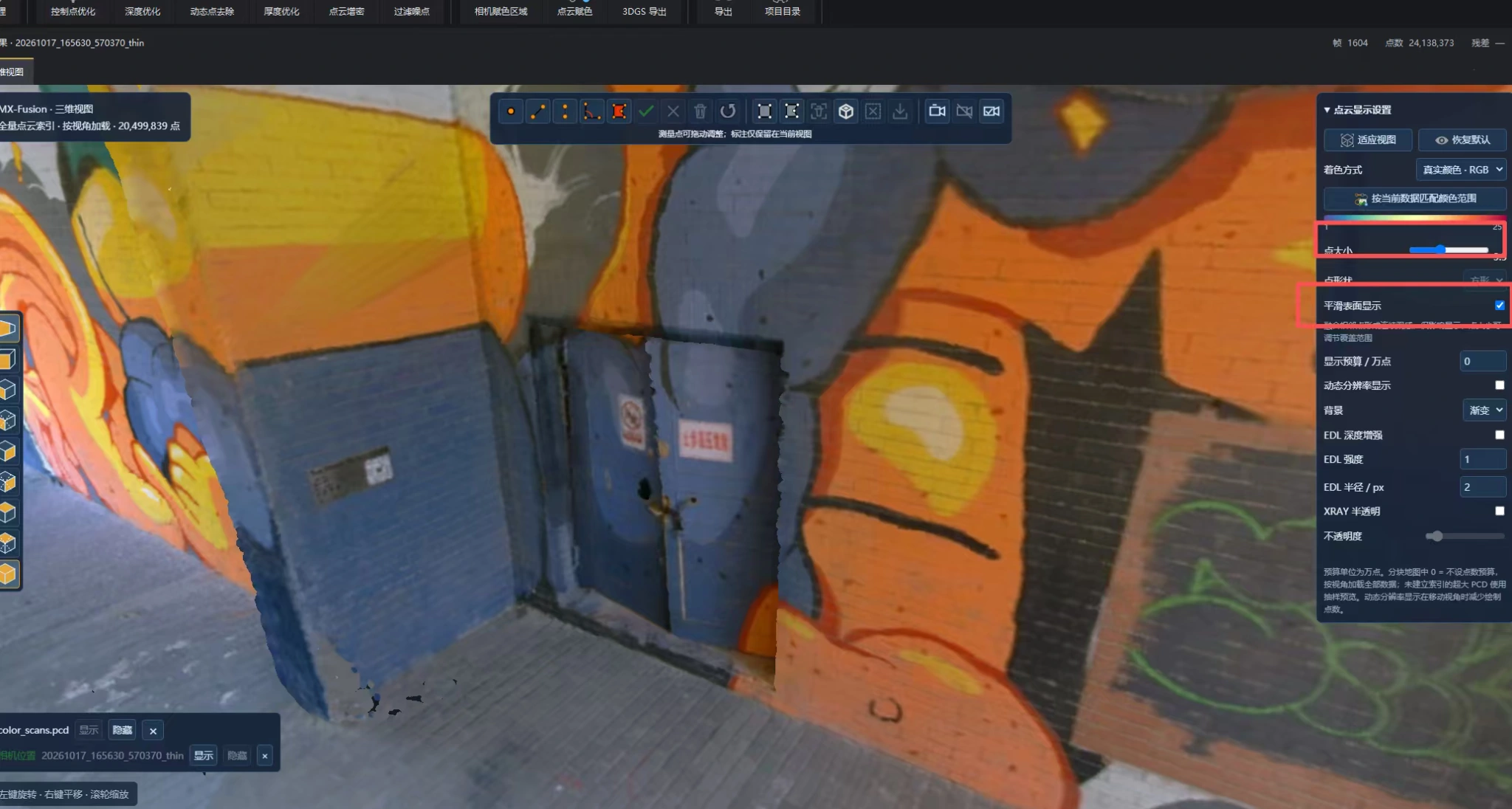
Close-range inspection adds another level of context: a doorway, a change in material, or a painted feature can be located within the wider model rather than reviewed as an isolated photograph.
05 / From processing to delivery
Export point clouds and 3DGS for different downstream tasks.
MX-Fusion exports colorized point clouds in LAS, LAZ, E57, and PLY formats. These outputs provide a route into compatible surveying, CAD, BIM, and 3D-processing applications for measurement, modeling, and existing-condition documentation.
The software also supports 3D Gaussian splatting (3DGS) output for scene visualization. Point clouds and 3DGS serve different roles: point clouds carry the spatial samples used in measurement workflows, while 3DGS provides a view-dependent visual representation of the scene. Select the deliverable around how the data will be used.
For a digital twin, the scan supplies the spatial foundation. Asset identifiers, records, system connections, and future updates build on that foundation to make it useful in operations.
06 / Practical applications
One capture platform, different project needs.
The same field-to-output workflow can support several kinds of spatial documentation. The capture plan and deliverable change with the task; the objective remains to bring real site conditions into a form the project team can use.
Surveying and infrastructure
Connect structures and surrounding terrain
Document site geometry, corridors, and infrastructure in spatial context. Use the data as an input to field-survey and engineering workflows, with control and checks matched to the project’s required tolerances.
Engineering surveying →Construction and industrial facilities
Record existing conditions before changes begin
Capture buildings, installed equipment, and the spaces around them to support renovation planning, model development, and coordination. A connected 3D record helps teams review spatial relationships before returning to the site.
Building and construction →Mining and forestry
Bring complex terrain into the dataset
Mine and stockpile surveys can use captured geometry as an input to surface modeling and volume calculations. Forestry teams can use spatial observations to support tree-height and canopy analysis, with visibility and coverage shaping the capture plan.
Heritage and digital twins
Preserve geometry and visual character
Combine colorized spatial records with the wider context of a building or site. The mural and courtyard examples illustrate two useful scales: recognizable surface detail and a connected view of the environment.
Heritage documentation →From site to spatial data
Make the field capture the beginning of a usable digital record.
Useful 3D documentation starts with what the team captures on site. Cobra connects a handheld scanning platform, live field feedback, RTK-SLAM positioning, and MX-Fusion processing so the workflow continues from the first pass through the environment to the final spatial deliverable.
For a building entrance, an industrial courtyard, a forest survey, or a heritage space, the starting point is the same: understand the environment, capture the required surfaces, and deliver data suited to the next decision.
Plan your capture workflow
See what Cobra can capture for your project.
Tell ModeXion about your site, positioning requirements, and target outputs. Review the Cobra configurations, explore sample data, or arrange a demonstration around your application.